 |
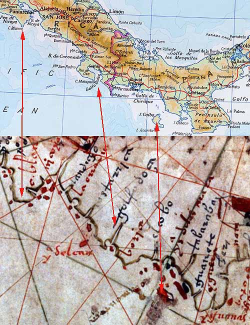
Comparison of modern map with vellum chart.

Y del [caño?] label in left lower center is shown rotated 180°. An island with that name (not shown on modern map above) lies in the Pta. San Pedro area. |
|---|
|
Comparison of modern map with vellum chart.
Y del [caño?] label in left lower center is shown rotated 180°. An island with that name (not shown on modern map above) lies in the Pta. San Pedro area. |
|---|