1798
ca. 1890
Engraving: “View in King Charles Island, one of the Galapagos Group.” In Robert Brown's
The Countries of the World, Being a Popular Description of the Various Continents, Islands, Rivers, Seas, and People of the Globe. Volume III:
Central America; South America. London: Cassell Petter & Galpin.
1927
1917
Drawings of old and new lighthouses at Isla San Cristóbal.
See also Ralph
Stock for lighthouse photo.
1712
2002
ca. 1880
Engraving of Albemarle Island. London(?): Details unknown.
1877
1893-94
Engraving “Giant Tortoises of the Galapagos Islands.” In
The Royal Natural History.
Volume V:
Reptiles and Fishes. 6 Volumes. London: Frederick Warne & Co.
1841
1817
1932
Ex Libris
Book Plate created for Captain George Allan Hancock, showing his
Velero III. Aircraft symbolizes the Allan Hancock College of Aeronautics.
NOTE: Requires free ExpressView Browser Plug-in from Lizard Tech. See Help Page for further details and download instructions.
 MrSID image format.
 JPEG 2000 image format.
1886
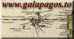
Map:
Galápagos Islands, Surveyed by Captain FitzRoy, R. N. and the Officers of H. M. S. Beagle, 1836. With corrections to 1926.
1798
Engraving: “Albemarle Island, the Westernmost of the Gallapagos Isles, Cape Berkeley.” In Atlas accompanying
Vancouver's Voyage of Discovery.
ca. 1530
Vellum Chart: Pacific coast from Guatemala to
Northern Perú.
1744
Map:
The Gallapagos Islands Discovered and Described by Capt. Cowley in 1684.1747
Map:
A New & Accurate Map of Mexico or New Spain together with California, New Mexico &c.
1579
Portrait of Abraham Ortelius. See also
Ortelius below.
1877
Engraving:
Wild Bull Shooting in the Galapagos Islands. (March 10 issue, p. 228)
1697
Map:
A Map of the World Shewing the Course of Mr. Dampier's Voyage Round it. From 1679 to 1691.1726
Map:
A New & Exact Map of the Coast, Countries and Islands within ye Limits of ye South Sea Company.
1570
Map:
Americae Sive Novi Orbis, Nova Descriptio.
Same.
1692
1943
Map:
Pacific Ocean, Special Map, Galapagos Islands, Seymour Island.
Aerial photo of island.
1942
Map:
Pacific Ocean, Galapagos Islands, Baltra Island. From a Survey by U. S. S. Bowditch in 1942. [First edition, apparent source for U. S. Army map above.—JW.]
1943
Map:
U. S. Naval Base, South Seymour Island, Galapagos Islands.
NOTE: Requires recent version of Windows Media Player or equivalent.
1932
1933
2004
Film Clip: U. S. Military Service Club, South Seymour Island, Galápagos Islands. From “The Rock: Galápagos en la II Guerra Mundial.”
2002-03
1933-34
2003
1933-34
Photos from Hancock Expeditions to Galápagos.
1937
Photos taken during visit of ship
Zavorah.
1920-60
2001-02
2004
1921
WW II
Photos and other items from WWII occupation of Galápagos Islands.
1943, 59
Aerial Photos from mapping missions by U. S. Army Air Forces (U. S. Air Force after 1947).
1945
Photos from “Galapagos Oasis” in
Caribbean Breeze, February, Vol. V., No. 2, pp.14-15.
1989
1942
Photos of possible grave site of Lt. John S. Cowan, in
Field Monograph of Galapagos Islands. Washington: U. S. Navy Department Office of Naval Intelligence.
—
1991
2004
Grave of Capt. Pringle Stokes, H. M. S.
Beagle, at Port Famine, Chile.
ca. 1920
Postcard showing lighthouse keeper's shack on Isla San Cristóbal. The “AZO” and triangle arrangement on back indicate postcard was printed between 1918 and 1930.
1935
1936
1938
Photo of Captain G. Allan Hancock at the Post Office Barrel, January 24, 1938. Photo courtesy John Garth.
1934
Envelope addressed to Captain G. Allan Hancock, from Rudolph Lorenz' brother Karl. Contents unknown. Postmark shows day (26) and year (34), but month is unknown.
1904
Postcard: Photo of Galápagos Insurrectionists.
1917
Postcard: H. M. S.
Lancaster crew members at Post Office barrel, Charles Island, November 28.
1934?
Envelope posted September 4, 1934(?) from Panama, showing sketch of Galápagos Lighthouse and ship
Seth Parker.
1938
3rd Presidential Cruise of the U. S. S. Houston.
Envelope mailed from Post Office Barrel by crewmember(?) E. J. Rall.
Envelopes postmarked on return voyage to U. S. A.